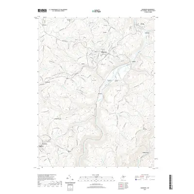
2019 Map of Kingwood
USGS Topo · Published 2019About this map
The Cheat River carves a deep path through Preston County, serving as the primary geographical axis for this region near the Briery Mountains. The town of Kingwood sits on the high ground west of the river, surrounded by a network of smaller communities including Irona, Snider, and Zevely. A significant transition in the local infrastructure is visible along the western edge of the map, where the WV Northern Rail-Trail follows the old rail corridor through Borgman and Tunnelton. Genealogists will find several burial sites preserved in the landscape, such as the Dinkerberger Family Cem and the Albright-Saint Joe Cem. The area's diverse valley floors are marked by the Dawson Army Airfield at Dunkard Bottom and the agricultural expanse of Moore Field near Preston.
Find a feature on this map
143 named features on this map. Tap any name to fly to it.
Don’t see what you’re looking for? This feature index may not catch every label — zoom into the map to look around manually.
Map Details
Editions of this 2019 Kingwood Map
This is the sole edition of this map. No revisions or reprints were ever made.
Other maps of this area

1886 · St. George
USGS Topo · 1:125,000

1891 · St. George
USGS Topo · 1:125,000

1902 · Morgantown
USGS Topo · 1:62,500

1904 · Bruceton
USGS Topo · 1:62,500

1907 · Thornton
USGS Topo · 1:62,500

1907 · Kingwood
USGS Topo · 1:62,500

1925 · Kingwood
USGS Topo · 1:62,500

1925 · Morgantown
USGS Topo · 1:62,500

1926 · Thornton
USGS Topo · 1:62,500

1926 · Bruceton
USGS Topo · 1:62,500