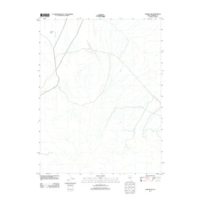
2011 Map of Kinkaid NW
USGS Topo · Published 2011About this map
Buckley Flat defines the upper portion of this Mineral County landscape, where the open terrain of the western Great Basin meets a network of ephemeral drainage systems. The primary hydrological feature is Nugent Wash, which threads through the desert flats as part of the broader drainage pattern typical of this arid region. Surveyed in 2011, this map captures the essential road network and physical geography of the high desert, providing a clear record of the area's natural contours and sparse human infrastructure. The lack of dense settlement in this specific quadrangle reflects the characteristic open space of rural Nevada, where topography and water access dictate the patterns of movement and use.
Find a feature on this map
2 named features on this map. Tap any name to fly to it.
Don’t see what you’re looking for? This feature index may not catch every label — zoom into the map to look around manually.
Map Details
Editions of this 2011 Kinkaid NW Map
This is the sole edition of this map. No revisions or reprints were ever made.
Other maps of this area

1909 · Hawthorne
USGS Topo · 1:250,000

1911 · Hawthorne
USGS Topo · 1:250,000

1915 · Hawthorne
USGS Topo · 1:250,000

1948 · Walker Lake
USGS Topo · 1:250,000

1955 · Hawthorne
USGS Topo · 1:62,500

1957 · Walker Lake
USGS Topo · 1:250,000

1962 · Walker Lake
USGS Topo · 1:250,000

1964 · Walker Lake
USGS Topo · 1:250,000

1964 · Gillis Canyon
USGS Topo · 1:62,500
1979 · Copper Mtn.
USGS Topo · 1:24,000