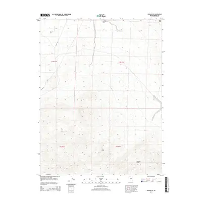
2014 Map of Kinkaid NW
USGS Topo · Published 2014About this map
Gillis Range dominates the southern portion of this Mineral County quadrangle, where the steep elevation contours give way to the prominent Paymaster Canyon and Sheeps Head Canyon. The landscape is defined by its arid, high-desert topography, with drainage patterns clearly visible along Nugent Wash and the flat expanses of Buckley Flat and Win Wan Valley to the north. Transportation through this remote terrain is limited to the corridor following Nv-31 and the utilitarian path of Poleline Rd, which cuts across the central basin. This survey provides a precise look at the township and range boundaries that grid this portion of the Great Basin, illustrating how the natural features like Rand Ridge intersect with the rigid land survey system in the early 21st century.
Find a feature on this map
13 named features on this map. Tap any name to fly to it.
Don’t see what you’re looking for? This feature index may not catch every label — zoom into the map to look around manually.
Map Details
Editions of this 2014 Kinkaid NW Map
This is the sole edition of this map. No revisions or reprints were ever made.
Other maps of this area

1909 · Hawthorne
USGS Topo · 1:250,000

1911 · Hawthorne
USGS Topo · 1:250,000

1915 · Hawthorne
USGS Topo · 1:250,000

1948 · Walker Lake
USGS Topo · 1:250,000

1955 · Hawthorne
USGS Topo · 1:62,500

1957 · Walker Lake
USGS Topo · 1:250,000

1962 · Walker Lake
USGS Topo · 1:250,000

1964 · Walker Lake
USGS Topo · 1:250,000

1964 · Gillis Canyon
USGS Topo · 1:62,500
1979 · Copper Mtn.
USGS Topo · 1:24,000