
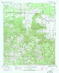
1936 Map of Kinlock Spring
USGS Topo · Published 1936About this map
Posey Mill sits at the heart of this 1930s landscape, serving as a focal point for a rural community defined by its water-powered industry and network of country churches. The map, produced through the collaboration of the Tennessee Valley Authority and the U.S. Geological Survey, illustrates the complex drainage of the Black Warrior Tennessee River Basin Divide. Evidence of New Deal-era activity is clear with the presence of CCC Camp No F 3 near Kinlock Spring.
Find a feature on this map
72 named features on this map. Tap any name to fly to it.
Don’t see what you’re looking for? This feature index may not catch every label — zoom into the map to look around manually.
Map Details
Editions of this 1936 Kinlock Spring Map
This is the sole edition of this map. No revisions or reprints were ever made.
Other maps of this area

1936 · Newburg
USGS Topo · 1:24,000

1936 · Delmar
USGS Topo · 1:24,000

1936 · Phil Campbell
USGS Topo · 1:24,000

1936 · Moulton
USGS Topo · 1:48,000

1936 · Spruce Pine
USGS Topo · 1:24,000

1936 · Goddard
USGS Topo · 1:24,000

1936 · Landersville
USGS Topo · 1:24,000

1940 · Mt Hope
USGS Topo · 1:62,500

1945 · Spruce Pine
USGS Topo · 1:24,000
1945 · Newburg
USGS Topo · 1:24,000