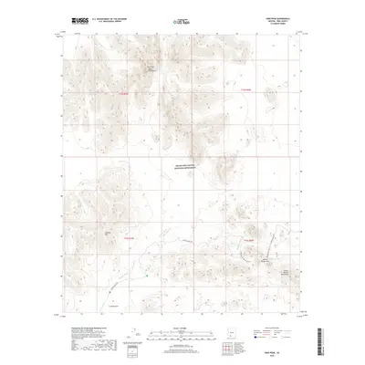
2018 Map of Kino Peak
USGS Topo · Published 2018About this map
Kino Peak Bates Mountains dominates the northern skyline of this desert landscape, situated within the expansive Organ Pipe Cactus National Monument. This 2018 survey reveals a terrain defined by high ridges and alluvial flats, where the La Abra Plain meets the rugged slopes of the Cipriano Hills and the Puerto Blanco Mountains. The mapping of the Aguajita Wash and other drainage patterns illustrates the crucial desert hydrology that dictated movement through this region long before the arrival of modern roads like Puerto Blanco Dr. Cultural and historical pathways are preserved through the inclusion of the Dripping Springs Trail and the Dripping Springs Mine Trail, leading toward the vital water source at Dripping Springs and through the natural notch of Blanco Pass.
Find a feature on this map
15 named features on this map. Tap any name to fly to it.
Don’t see what you’re looking for? This feature index may not catch every label — zoom into the map to look around manually.
Map Details
Editions of this 2018 Kino Peak Map
This is the sole edition of this map. No revisions or reprints were ever made.
Other maps of this area

1953 · Ajo
USGS Topo · 1:250,000

1954 · Sonoyta
USGS Topo · 1:250,000

1957 · Ajo
USGS Topo · 1:250,000

1958 · Ajo
USGS Topo · 1:250,000

1962 · Ajo
USGS Topo · 1:250,000

1963 · Ajo
USGS Topo · 1:250,000

1963 · Lukeville
USGS Topo · 1:62,500

1963 · Quitobaquito Springs
USGS Topo · 1:62,500

1963 · Kino Peak
USGS Topo · 1:62,500

1963 · Lukeville
USGS Topo · 1:250,000