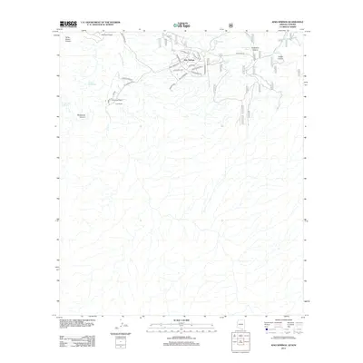
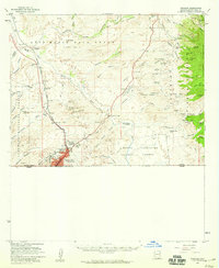
2012 Map of Kino Springs
USGS Topo · Published 2012About this map
Kino Springs is the primary settlement on this borderlands landscape, where residential street names like Stirrup St, Roundup Rd, and Stagecoach Way evoke a deliberate Western equestrian character. The terrain is deeply defined by the Santa Cruz River and a series of rugged drainages including Yerba Buena Canyon and Brickwood Canyon. Long-established ranching interests are evident in the presence of Yerba Buena Ranch, Buena Vista Ranch, and Lows Ranch, which dot the foothills and river valley. Along the western edge of the community, El Camino Real traces a historic route, while a network of stock tanks such as Quien Sabe Tank and Chamberlain Tank provides essential water for the arid environment. Further east, the landscape becomes increasingly dramatic as it enters Sycamore Canyon and Italian Canyon, emphasizing the remote, canyon-slashed nature of the Arizona-Sonora border region.
Find a feature on this map
35 named features on this map. Tap any name to fly to it.
Don’t see what you’re looking for? This feature index may not catch every label — zoom into the map to look around manually.
Map Details
Editions of this 2012 Kino Springs Map
This is the sole edition of this map. No revisions or reprints were ever made.
Other maps of this area

1905 · Nogales
USGS Topo · 1:125,000

1932 · Lochiel
USGS Topo · 1:62,500

1933 · Calabasas
USGS Topo · 1:62,500

1948 · Harshaw
USGS Topo · 1:24,000
1948 · Duquesne
USGS Topo · 1:24,000
1948 · Lochiel
USGS Topo · 1:62,500

1956 · Nogales
USGS Topo · 1:250,000

1958 · Nogales
USGS Topo · 1:250,000
1958 · Duquesne
USGS Topo · 1:24,000
1958 · Nogales
USGS Topo · 1:62,500