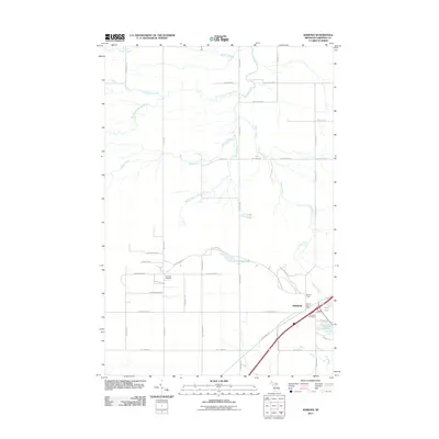
2011 Map of Kinross
USGS Topo · Published 2011About this map
Kinross serves as the focal point of this 2011 survey, situated in a landscape defined by an extensive network of waterways and precisely gridded rural roads. The township's infrastructure is anchored by the Kinross Post Office and Kinross Tower, while local history is preserved at the Rudyard Cemetery and Lake View Cemetery. The terrain is dominated by the Waiska River and its branches, including the West Branch Waiska River and South Branch Waiska River, which drain the low-lying areas into local basins like Eagle Lake and Garkinghouse Lake. The intersection of S Mackinac Trl and various section-line roads such as W 12 Mile Rd illustrates the late 20th-century development of this Chippewa County region, where legacy agricultural boundaries meet more modern transport corridors near Mud Lake and Kinross Lake.
Find a feature on this map
46 named features on this map. Tap any name to fly to it.
Don’t see what you’re looking for? This feature index may not catch every label — zoom into the map to look around manually.
Map Details
Editions of this 2011 Kinross Map
This is the sole edition of this map. No revisions or reprints were ever made.
Other maps of this area

1913 · Sault Sainte Marie
USGS Topo · 1:62,500

1941 · Sault Sainte Marie
USGS Topo · 1:63,360

1941 · Brimley
USGS Topo · 1:63,360

1951 · Shallows
USGS Topo · 1:24,000

1951 · Dollar Settlement
USGS Topo · 1:24,000

1951 · Raco
USGS Topo · 1:24,000

1951 · Kinross
USGS Topo · 1:24,000

1951 · Dafter
USGS Topo · 1:24,000

1951 · Brimley
USGS Topo · 1:62,500

1951 · Sault Ste. Marie
USGS Topo · 1:62,500