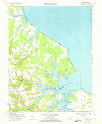
1968 Map of Kinsale
USGS Topo · Published 1972About this map
Yeocomico Ch and Yeocomico Chapel anchor the historical landscape of the Northern Neck during the late 1960s, a region defined by its intricate shoreline where the NW Yeocomico River meets the Potomac River. The settlement of Kinsale sits prominently at the head of a sheltered branch, surrounded by family-named landmarks like Shingle Hill and Grays Corner. This survey captures the traditional maritime and agricultural character of Westmoreland and Northumberland counties before modern development altered the rural waterfront. Land use is characterized by numerous small inlets and points, including Sandy Point Neck and Cherry Point Neck, with inland resources represented by Thompson Millpond and scattered Gravel Pits. Local genealogy is well-served by the presence of sites like Bailey Cem and several country churches, including Zion Ch and New Jerusalem Ch.
Find a feature on this map
91 named features on this map. Tap any name to fly to it.
Don’t see what you’re looking for? This feature index may not catch every label — zoom into the map to look around manually.
Map Details
Editions of this 1968 Kinsale Map
4 editions found
Other maps of this area

1892 · Piney Point
USGS Topo · 1:62,500

1894 · Piney Point
USGS Topo · 1:62,500

1894 · Point Lookout
USGS Topo · 1:62,500

1895 · Nomini
USGS Topo · 1:125,000

1895 · Piney Point
USGS Topo · 1:62,500

1898 · Nomini
USGS Topo · 1:125,000

1898 · St. Marys
USGS Topo · 1:125,000

1901 · Piney Point
USGS Topo · 1:62,500

1906 · St. Marys
USGS Topo · 1:125,000

1912 · Point Lookout
USGS Topo · 1:62,500