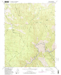
1992 Map of Kinsley
USGS Topo · Published 1995About this map
McCauley Ranch (Old Stage Station) and Jenkins Ranch anchor this high-elevation landscape in eastern Mariposa County, where the deep canyons of the Merced River meet the steep slopes of the Stanislaus National Forest. The geography is defined by a network of ridges and flats, from Big Grizzly Mountain to the secluded Deer Flat. This survey traces the early infrastructure of the region, including the winding Ponderosa Way and Briceburg Road, alongside legacy mining sites like the Garibaldi Mine (Aband). Along the river's bend, a Geological Exhibit and the Ferguson Dump mark specific human interactions with this protected corridor, now designated as part of the South Fork Merced Wild and Scenic River. The map illustrates the complex intersection of federal forest management, early ranching, and the preservation of free-flowing river systems.
Find a feature on this map
48 named features on this map. Tap any name to fly to it.
Don’t see what you’re looking for? This feature index may not catch every label — zoom into the map to look around manually.
Map Details
Editions of this 1992 Kinsley Map
2 editions found
Other maps of this area

1893 · Sonora
USGS Topo · 1:125,000

1896 · Sonora
USGS Topo · 1:125,000

1897 · Sonora
USGS Topo · 1:125,000

1897 · Yosemite
USGS Topo · 1:125,000

1898 · Sonora
USGS Topo · 1:125,000

1900 · Yosemite
USGS Topo · 1:125,000

1903 · Yosemite
USGS Topo · 1:125,000

1909 · Yosemite
USGS Topo · 1:125,000

1947 · El Portal
USGS Topo · 1:24,000

1947 · San Jose
USGS Topo · 1:250,000