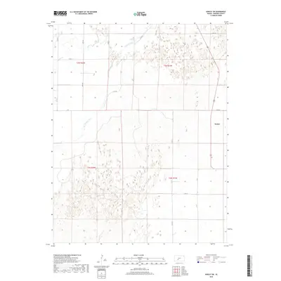
2018 Map of Kinsley SW
USGS Topo · Published 2018About this map
The Arkansas River winds through the northwestern corner of this Edwards County landscape, a vital water source in the high plains of Kansas. The small settlement of Hodges occupies the eastern edge of the quadrangle, serving as a focal point for the surrounding agricultural tracts. The terrain is characterized by a dense network of county roads, such as Co Rd 19 and Co Rd 36, which follow the rigid grid of the Public Land Survey System, including divisions like t25s r20w and t26s r19w. In the northwest, Coon Cr joins the river system, carving a subtle drainage path across the prairie. This 2018 survey reveals a modern rural environment defined by its commitment to large-scale ranching and farming, where the infrastructure of local travel remains tied to the historical section lines established generations ago.
Find a feature on this map
18 named features on this map. Tap any name to fly to it.
Don’t see what you’re looking for? This feature index may not catch every label — zoom into the map to look around manually.
Map Details
Editions of this 2018 Kinsley SW Map
This is the sole edition of this map. No revisions or reprints were ever made.
Other maps of this area

1889 · Kinsley
USGS Topo · 1:125,000

1892 · Kinsley
USGS Topo · 1:125,000

1892 · Spearville
USGS Topo · 1:125,000

1894 · Spearville
USGS Topo · 1:125,000

1894 · Kinsley
USGS Topo · 1:125,000

1955 · Pratt
USGS Topo · 1:250,000

1959 · Pratt
USGS Topo · 1:250,000

1969 · Bucklin NE
USGS Topo · 1:24,000

1969 · Greensburg NW
USGS Topo · 1:24,000
1969 · Greensburg NE
USGS Topo · 1:24,000