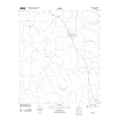
2011 Map of Kinston
USGS Topo · Published 2011About this map
Kinston serves as a central hub on this landscape, with its residential streets like Suzanne St and Sumblin St radiating from the Kinston Post Office. This area is marked by a complex network of creeks and branches that define the local drainage, including Flat Creek, Cripple Creek, and the Pea River along the eastern boundary. The presence of multiple burial grounds, such as Beulah Cemetery and Saint Pauls Cemetery, highlights the established community roots that stretch across the rural intersections of Estothel and Earlytown.
Find a feature on this map
78 named features on this map. Tap any name to fly to it.
Don’t see what you’re looking for? This feature index may not catch every label — zoom into the map to look around manually.
Map Details
Editions of this 2011 Kinston Map
This is the sole edition of this map. No revisions or reprints were ever made.
Other maps of this area

1953 · Andalusia
USGS Topo · 1:250,000

1957 · Andalusia
USGS Topo · 1:250,000
1968 · Samson
USGS Topo · 1:24,000
1968 · Ino
USGS Topo · 1:24,000
1968 · Sellersville
USGS Topo · 1:24,000

1968 · Opp East
USGS Topo · 1:24,000
1969 · Hacoda
USGS Topo · 1:24,000
1969 · Kinston
USGS Topo · 1:24,000

1971 · Onycha
USGS Topo · 1:24,000
1971 · Florala
USGS Topo · 1:24,000