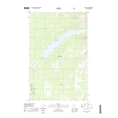
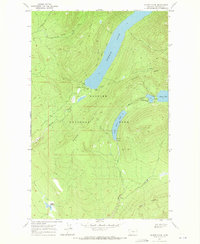
2020 Map of Kintla Lake
USGS Topo · Published 2020About this map
Glacier National Park defines the high-altitude landscape of this northern Montana quadrangle, where glacial activity and steep drainage systems have carved deep basins. Central to the sheet is the elongated Kintla Lake, which sits between the towering Starvation Ridge to the west and Parke Ridge to the east. The presence of the Rainbow Glacier at the head of Ford Cr highlights the active cryosphere of the region, while the Boundary Mountains mark the northern limits of the terrain. Connectivity is limited to the primitive Inside North Fork Road and the Boulder Pass trail, reflecting the preserved wilderness character of the Flathead Wild and Scenic River corridor. Water systems like Kishenehn Creek and Starvation Cr feed into these larger features, illustrating a rugged, untouched ecosystem at the turn of the twenty-first century.
Find a feature on this map
17 named features on this map. Tap any name to fly to it.
Don’t see what you’re looking for? This feature index may not catch every label — zoom into the map to look around manually.
Map Details
Editions of this 2020 Kintla Lake Map
This is the sole edition of this map. No revisions or reprints were ever made.
Other maps of this area

1906 · Kintla Lakes
USGS Topo · 1:125,000

1938 · Kintla Lakes
USGS Topo · 1:125,000

1957 · Kalispell
USGS Topo · 1:250,000

1960 · Kalispell
USGS Topo · 1:250,000

1961 · Kalispell
USGS Topo · 1:250,000

1966 · Kintla Lake
USGS Topo · 1:24,000
1966 · Whale Buttes
USGS Topo · 1:24,000
1966 · Polebridge
USGS Topo · 1:24,000
1966 · Trailcreek
USGS Topo · 1:24,000
1968 · Quartz Ridge
USGS Topo · 1:24,000