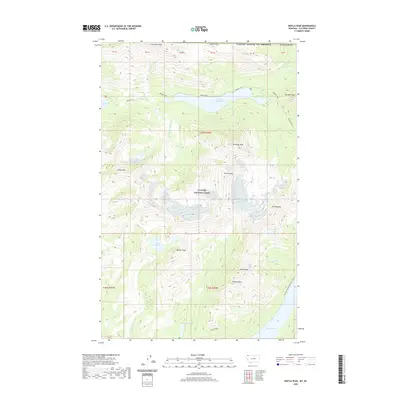
2020 Map of Kintla Peak
USGS Topo · Published 2020About this map
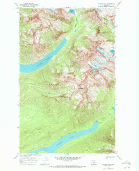
Glacier National Park defines this high-altitude landscape in Flathead County, where the continental divide and international boundary meet. The topography is dominated by massive summits such as Kintla Peak and Kinnerly Peak, which rise steeply above glacial basins. Water is central to the area's geography, with the long, narrow finger of Kintla Lake leading to Upper Kintla Lake, both fed by tributaries like Agassiz Creek and Long Knife Creek. The human footprint is limited to backcountry travel routes, most notably the Pacific NW National Scenic Trail as it winds through the southern portion of the sheet. Further north, Boulder Pass provides a critical crossing point between the peaks, connecting the Kintla drainage with the upper reaches of the park. The map also captures the headwaters of Akokala Creek and the shores of Bowman Lake, illustrating a pristine wilderness structured by vertical relief and high-mountain lakes.
Find a feature on this map
39 named features on this map. Tap any name to fly to it.
Don’t see what you’re looking for? This feature index may not catch every label — zoom into the map to look around manually.
Map Details
Editions of this 2020 Kintla Peak Map
This is the sole edition of this map. No revisions or reprints were ever made.
Other maps of this area

1906 · Kintla Lakes
USGS Topo · 1:125,000

1938 · Kintla Lakes
USGS Topo · 1:125,000

1957 · Kalispell
USGS Topo · 1:250,000

1960 · Kalispell
USGS Topo · 1:250,000

1961 · Kalispell
USGS Topo · 1:250,000

1966 · Kintla Lake
USGS Topo · 1:24,000
1966 · Polebridge
USGS Topo · 1:24,000
1968 · Quartz Ridge
USGS Topo · 1:24,000
1968 · Kintla Peak
USGS Topo · 1:24,000
1968 · Vulture Peak
USGS Topo · 1:24,000