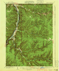
1941 Map of Kinzua
USGS Topo · Published 1941About this map
The Cornplanter Indian Reservation sits prominently along the western bank of the Allegheny River, a significant cultural and geographic anchor in this 1941 survey of the Warren and McKean County line. The settlement of Kinzua acts as a hub at the junction of the river and Kinzua Creek, surrounded by industrial activity including the Kinzua Coal Mine and the rail corridors of the Pennsylvania railroad.
Find a feature on this map
84 named features on this map. Tap any name to fly to it.
Don’t see what you’re looking for? This feature index may not catch every label — zoom into the map to look around manually.
Map Details
Editions of this 1941 Kinzua Map
3 editions found

Other maps of this area

1900 · Salamanca
USGS Topo · 1:62,500

1905 · Jamestown
USGS Topo · 1:62,500

1906 · Warren
USGS Topo · 1:62,500

1907 · Warren
USGS Topo · 1:62,500

1908 · Warren
USGS Topo · 1:62,500

1922 · Randolph
USGS Topo · 1:62,500

1923 · Randolph
USGS Topo · 1:62,500

1924 · Bradford
USGS Topo · 1:62,500

1926 · Bradford
USGS Topo · 1:62,500

1934 · Kane
USGS Topo · 1:48,000