
1941 Map of Kinzua
USGS Topo · Published 1941About this map
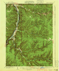
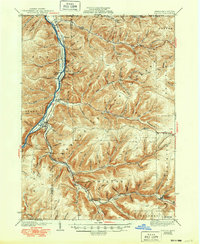
The Cornplanter Indian Reservation occupies a narrow strip of land along the eastern bank of the Allegheny River, highlighting a significant indigenous presence in this river valley before the mid-century landscape was altered by water management projects. This 1941 edition, based on surveys from the mid-1930s, documents the tight relationship between the river, the Pennsylvania Railroad, and the settlements of Corydon and Kinzua. The terrain is characterized by deeply incised hollows and ridges, such as Roper Hollow and Bullis Hollow, where small settlements and camps like the Boy Scout Camp found footing.
Find a feature on this map
73 named features on this map. Tap any name to fly to it.
Don’t see what you’re looking for? This feature index may not catch every label — zoom into the map to look around manually.
Map Details
Editions of this 1941 Kinzua Map
3 editions found
Other maps of this area

1900 · Salamanca
USGS Topo · 1:62,500

1905 · Jamestown
USGS Topo · 1:62,500

1906 · Warren
USGS Topo · 1:62,500

1907 · Warren
USGS Topo · 1:62,500

1908 · Warren
USGS Topo · 1:62,500

1922 · Randolph
USGS Topo · 1:62,500

1923 · Randolph
USGS Topo · 1:62,500

1924 · Bradford
USGS Topo · 1:62,500

1926 · Bradford
USGS Topo · 1:62,500

1934 · Kane
USGS Topo · 1:48,000