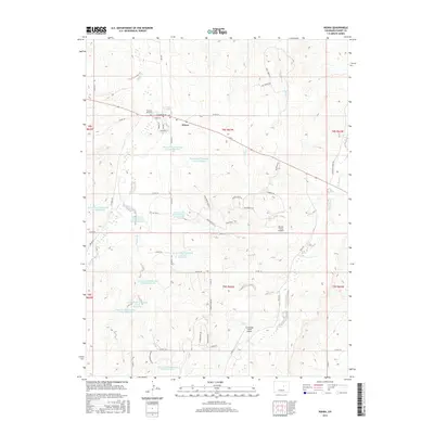
2016 Map of Kiowa
USGS Topo · Published 2016About this map
Kiowa serves as the focal point for this Elbert County landscape, where the town's street grid is defined by names such as Navajo St, Pawnee St, and Colorado St. North of the settlement, the Hungate Memorial stands near the intersection of Co Rd 134 and Co Rd 37. The area is characterized by a high concentration of water management infrastructure, including numerous reservoirs such as Kiowa Creek Watershed 3-B-60 Reservoir and Kiowa Creek Watershed 3-A-10 Reservoir, which catch the intermittent flows of Kiowa Cr, Wolf Cr, and Gopher Cr. This network of man-made reservoirs suggests a landscape heavily modified for water storage and flood control. Aviation is represented by both Wecker Farms Airport and Comanche Creek Airport, while rural development is evident in newer residential road names like Whispering Pines Pl and Hidden Valley Pl.
Find a feature on this map
60 named features on this map. Tap any name to fly to it.
Don’t see what you’re looking for? This feature index may not catch every label — zoom into the map to look around manually.
Map Details
Editions of this 2016 Kiowa Map
This is the sole edition of this map. No revisions or reprints were ever made.
Other maps of this area

1894 · Castle Rock
USGS Topo · 1:125,000

1913 · Castle Rock
USGS Topo · 1:125,000

1939 · Elizabeth
USGS Topo · 1:62,500

1940 · Elbert
USGS Topo · 1:62,500

1944 · Elbert
USGS Topo · 1:62,500

1945 · Elizabeth
USGS Topo · 1:62,500

1953 · Denver
USGS Topo · 1:250,000

1957 · Denver
USGS Topo · 1:250,000

1958 · Denver
USGS Topo · 1:250,000

1960 · Denver
USGS Topo · 1:250,000