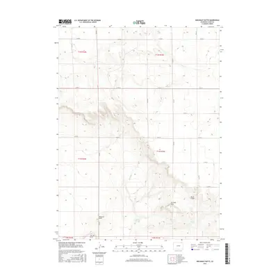
2016 Map of Kirchnavy Butte
USGS Topo · Published 2016About this map
Kirchnavy Butte stands as a prominent landmark in this high plains landscape of northeastern Colorado. The topography is defined by significant elevation changes, particularly around the eponymous butte and the distinct formation known as Molly and Mable. Further south, Flat Top Butte adds to the cluster of named geologic features that provided vital orientation for early travellers and ranchers in Logan County.
Find a feature on this map
25 named features on this map. Tap any name to fly to it.
Don’t see what you’re looking for? This feature index may not catch every label — zoom into the map to look around manually.
Map Details
Editions of this 2016 Kirchnavy Butte Map
This is the sole edition of this map. No revisions or reprints were ever made.
Other maps of this area

1951 · Padroni NW
USGS Topo · 1:24,000

1952 · Padroni
USGS Topo · 1:24,000

1954 · Sterling
USGS Topo · 1:250,000

1954 · Scottsbluff
USGS Topo · 1:250,000

1958 · Scottsbluff
USGS Topo · 1:250,000

1958 · Sterling
USGS Topo · 1:250,000

1972 · Easterly Airport
USGS Topo · 1:24,000

1972 · Potter SW
USGS Topo · 1:24,000

1972 · Potter SE
USGS Topo · 1:24,000
1978 · Kirchnavy Butte
USGS Topo · 1:24,000