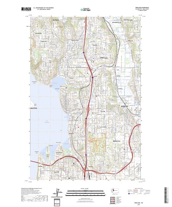
2023 Map of Kirkland
USGS Topo · Published 2023About this map
Lake Washington defines the western edge of this suburban corridor, where the residential grids of Kirkland and Bellevue meet the Sammamish River valley. The map documents a densely developed landscape punctuated by significant institutional landmarks and green spaces, from Northwest University in Houghton to the Lake Washington Institute of Technology further north. Elevated terrain at Norway Hill and Finn Hill provides a contrast to the low-lying Sammamish Valley, where Woodinville and Hollywood sit near the river's path.
Find a feature on this map
139 named features on this map. Tap any name to fly to it.
Don’t see what you’re looking for? This feature index may not catch every label — zoom into the map to look around manually.
Map Details
Editions of this 2023 Kirkland Map
This is the sole edition of this map. No revisions or reprints were ever made.
Other maps of this area

1894 · Seattle
USGS Topo · 1:62,500

1895 · Snohomish
USGS Topo · 1:125,000

1897 · Seattle
USGS Topo · 1:125,000

1908 · Seattle
USGS Topo · 1:62,500

1909 · Seattle Special
USGS Topo · 1:62,500

1942 · Edmonds
USGS Topo · 1:62,500

1944 · Everett
USGS Topo · 1:62,500

1949 · Seattle North
USGS Topo · 1:24,000
1949 · Seattle South
USGS Topo · 1:24,000

1950 · Redmond
USGS Topo · 1:24,000