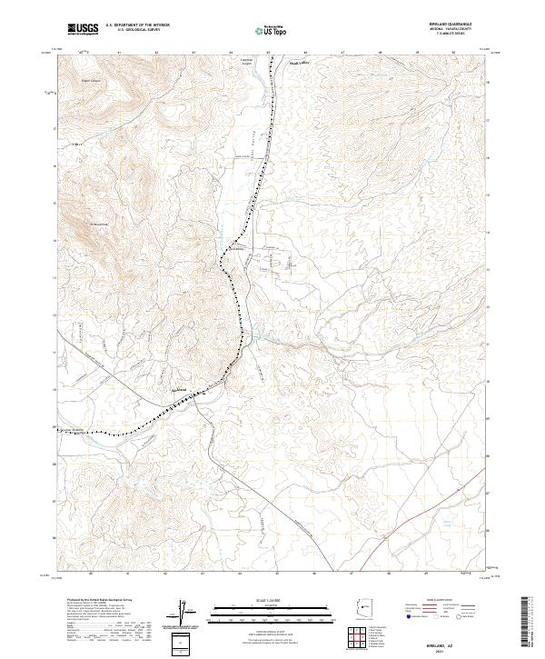
2021 Map of Kirkland
USGS Topo · Published 2021About this map
Skull Valley and Kirkland serve as the primary hubs in this high-desert region of Yavapai County, where the settlement pattern follows the drainage of Skull Valley Wash. The landscape is defined by the transition from the sharp relief of Kirkland Peak down to the alluvial floor of Lower Kirkland Valley. Historical ranching and rural access are evidenced by a dense network of local roads with evocative names like Loose Cow Rd and Cattle Call Rd, while the hydrology is marked by ephemeral features such as Moonville Cr and Finch Wash. Farther south, Kirkland Creek winds through the valley floor, supported by cattle tanks like Elmer Tank and Middle Tank that reflect the area's long-standing agricultural and grazing heritage. The map also captures the rugged northern reaches of Coughran Canyon and Dipper Canyon, providing a precise look at the terrain before it drops toward the Hassayampa drainage.
Find a feature on this map
43 named features on this map. Tap any name to fly to it.
Don’t see what you’re looking for? This feature index may not catch every label — zoom into the map to look around manually.
Map Details
Editions of this 2021 Kirkland Map
This is the sole edition of this map. No revisions or reprints were ever made.
Other maps of this area

1887 · Prescott
USGS Topo · 1:250,000

1892 · Prescott
USGS Topo · 1:250,000

1903 · Congress
USGS Topo · 1:125,000

1904 · Congress
USGS Topo · 1:125,000

1947 · Iron Springs
USGS Topo · 1:62,500

1947 · Kirkland
USGS Topo · 1:62,500

1947 · Sheridan Mountain
USGS Topo · 1:62,500

1948 · Sheridan Mountain
USGS Topo · 1:63,360

1948 · Iron Springs
USGS Topo · 1:63,360

1948 · Kirkland
USGS Topo · 1:63,360