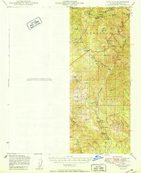
1950 Map of Kirkland
USGS Topo · Published 1950About this map
Mining and ranching activity defines this post-war landscape within the Prescott National Forest. The map documents a rugged interior network of gulches and mountain washes, centering on the upper reaches of the Hassayampa River. Along the river valley, the small community of Walnut Grove serves as a hub for local agricultural and educational life, anchored by the Walnut Grove School. Individual landholdings like the T K Bar Ranch, Carter Ranch, and Whitehead Ranch are clearly delineated, providing critical data for genealogists and land-use researchers.
Find a feature on this map
43 named features on this map. Tap any name to fly to it.
Don’t see what you’re looking for? This feature index may not catch every label — zoom into the map to look around manually.
Map Details
Editions of this 1950 Kirkland Map
This is the sole edition of this map. No revisions or reprints were ever made.
Other maps of this area

1887 · Prescott
USGS Topo · 1:250,000

1892 · Prescott
USGS Topo · 1:250,000

1903 · Bradshaw Mountains
USGS Topo · 1:125,000

1903 · Congress
USGS Topo · 1:125,000

1904 · Congress
USGS Topo · 1:125,000

1905 · Jerome
USGS Topo · 1:125,000

1947 · Crown King
USGS Topo · 1:62,500

1947 · Iron Springs
USGS Topo · 1:62,500

1947 · Mt. Union
USGS Topo · 1:62,500

1947 · Kirkland
USGS Topo · 1:62,500