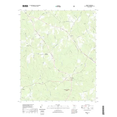
2020 Map of Kirksey
USGS Topo · Published 2020About this map
Kirksey and Gaines Crossroads anchor this rural landscape in Greenwood County, where the southern portion of the map is defined by the wooded expanse of the Sumter National Forest. The area is characterized by a dense network of watercourses, including Cuffytown Cr and its tributaries such as Horsepen Cr and Honeypen Cr. These streams shaped the early settlement patterns of small communities like Phoenix and Callison, which are connected by a web of local roads named for prominent families and landmarks. The geography reveals a transition from the agricultural clearings near Epworth to the more heavily forested creek bottoms. Local history is etched into the names of the landscape, from Catholic Br to Mount Carmel Br, suggesting the cultural and religious foundations of the region's inhabitants.
Find a feature on this map
72 named features on this map. Tap any name to fly to it.
Don’t see what you’re looking for? This feature index may not catch every label — zoom into the map to look around manually.
Map Details
Editions of this 2020 Kirksey Map
This is the sole edition of this map. No revisions or reprints were ever made.
Other maps of this area

1892 · Mc Cormick
USGS Topo · 1:125,000

1892 · Abbeville
USGS Topo · 1:125,000

1908 · Kirksey
USGS Topo · 1:24,000

1912 · Mc Cormick
USGS Topo · 1:125,000

1941 · Spartanburg
USGS Topo · 1:250,000

1949 · Ninety-Six
USGS Topo · 1:24,000

1949 · Greenwood
USGS Topo · 1:24,000

1950 · Bradley
USGS Topo · 1:24,000

1950 · Kirksey
USGS Topo · 1:24,000

1953 · Athens
USGS Topo · 1:250,000