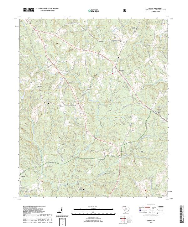
2024 Map of Kirksey
USGS Topo · Published 2024About this map
Cuffytown Creek winds through this rural Greenwood County landscape, serving as a primary drainage for a region characterized by small crossroads settlements and deep-rooted community institutions. At Gaines Crossroads, several family-named roads like McFerrin Rd and Kathy Hill Rd converge near the historical religious centers of First Damascus Baptist Church and its neighboring congregation. This area remains largely defined by its timberlands and agriculture, with significant portions of the southern terrain protected within the Sumter National Forest.
Find a feature on this map
80 named features on this map. Tap any name to fly to it.
Don’t see what you’re looking for? This feature index may not catch every label — zoom into the map to look around manually.
Map Details
Editions of this 2024 Kirksey Map
This is the sole edition of this map. No revisions or reprints were ever made.
Other maps of this area

1892 · Mc Cormick
USGS Topo · 1:125,000

1892 · Abbeville
USGS Topo · 1:125,000

1908 · Kirksey
USGS Topo · 1:24,000

1912 · Mc Cormick
USGS Topo · 1:125,000

1941 · Spartanburg
USGS Topo · 1:250,000

1949 · Ninety-Six
USGS Topo · 1:24,000

1949 · Greenwood
USGS Topo · 1:24,000

1950 · Bradley
USGS Topo · 1:24,000

1950 · Kirksey
USGS Topo · 1:24,000

1953 · Athens
USGS Topo · 1:250,000