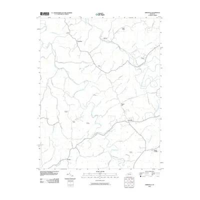
2010 Map of Kirksville
USGS Topo · Published 2010About this map
Kirksville and Cottonburg anchor a Madison County landscape defined by the intricate winding of Paint Lick Creek and its many tributaries. This 2010 survey illustrates a rural environment where local history is preserved in family and community burial grounds, such as Poosey Cemetery in the north and Kinnard Cemetery near the south. The terrain is marked by significant features like Round Hill and Crow Valley, while the road network connects small settlements like Nina, Ruthton, and Hackley. The naming of waterways, including Bogie Branch and Broadus Branch, suggests long-standing family associations with the land. These details, alongside the presence of many dead-end ridges like Nina Ridge Rd and Kelly Ridge Rd, provide an look at how the topography has shaped settlement patterns and road development in this part of Kentucky.
Find a feature on this map
56 named features on this map. Tap any name to fly to it.
Don’t see what you’re looking for? This feature index may not catch every label — zoom into the map to look around manually.
Map Details
Editions of this 2010 Kirksville Map
This is the sole edition of this map. No revisions or reprints were ever made.
Other maps of this area

1892 · Richmond
USGS Topo · 1:125,000

1897 · Richmond
USGS Topo · 1:125,000

1905 · Harrodsburg
USGS Topo · 1:125,000

1952 · Berea
USGS Topo · 1:24,000

1952 · Valley View
USGS Topo · 1:24,000

1952 · Little Hickman
USGS Topo · 1:24,000

1952 · Buckeye
USGS Topo · 1:24,000

1952 · Paint Lick
USGS Topo · 1:24,000

1952 · Lancaster
USGS Topo · 1:24,000

1952 · Kirksville
USGS Topo · 1:24,000