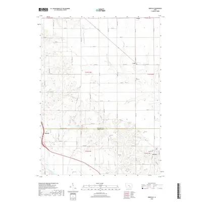
2018 Map of Kirkville
USGS Topo · Published 2018About this map
Eddyville and Kirkville anchor this southern Iowa landscape along the Des Moines River, where the terrain transitions from flat agricultural uplands into the dissected drainages of the Mahaska Co Wapello Co border. Small settlements like Wright and Cedar are interspersed among a dense grid of rural roads, including Co Hwy T67 and Wapello Mahaska Rd. Genealogists will find a high concentration of burial sites throughout the townships, such as Westview Cem, Stump Cem, and the Funk Family Cem. The natural drainage of the region is defined by numerous tributaries, with Little Muchakinock Cr and Brown Cr cutting through the central sections. The map preserves the exact alignment of historical thoroughfares like Richland Rd and Columbia Rd, reflecting a landscape deeply shaped by the Public Land Survey System.
Find a feature on this map
45 named features on this map. Tap any name to fly to it.
Don’t see what you’re looking for? This feature index may not catch every label — zoom into the map to look around manually.
Map Details
Editions of this 2018 Kirkville Map
This is the sole edition of this map. No revisions or reprints were ever made.
Other maps of this area

1954 · Des Moines
USGS Topo · 1:250,000

1956 · Des Moines
USGS Topo · 1:250,000

1956 · Ottumwa North
USGS Topo · 1:62,500

1956 · Ottumwa North
USGS Topo · 1:24,000

1957 · Des Moines
USGS Topo · 1:250,000

1965 · Rose Hill
USGS Topo · 1:24,000

1968 · University Park
USGS Topo · 1:24,000

1968 · Oskaloosa
USGS Topo · 1:24,000

1968 · Kirkville
USGS Topo · 1:24,000

1968 · Eddyville
USGS Topo · 1:24,000