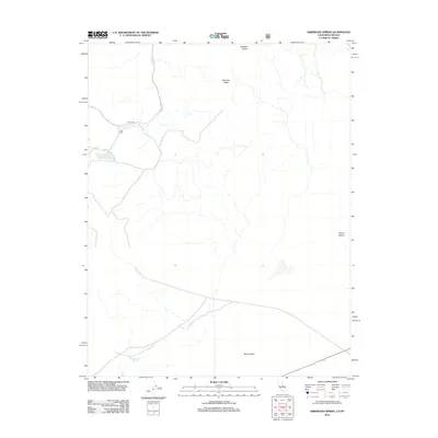
2012 Map of Kirkwood Spring
USGS Topo · Published 2012About this map
Bodie Cr flows through the northern reaches of this high-elevation landscape, where the remnants of early industrial activity are preserved in labels like Gray Mill and the Toll House. These features suggest a history of resource extraction and transit through the high country long before modern recreational use. The terrain is defined by significant elevations, including Brawley Peaks, which overlook the expansive Mono Valley to the south. Water sources are critical in this arid environment, marked here by Kirkwood Spring. The layout of the road network and the presence of Trench Canyon indicate a landscape where travel was dictated by the difficult geography of the eastern Sierra region.
Find a feature on this map
7 named features on this map. Tap any name to fly to it.
Don’t see what you’re looking for? This feature index may not catch every label — zoom into the map to look around manually.
Map Details
Editions of this 2012 Kirkwood Spring Map
This is the sole edition of this map. No revisions or reprints were ever made.
Other maps of this area

1909 · Hawthorne
USGS Topo · 1:250,000

1909 · Bridgeport
USGS Topo · 1:125,000

1911 · Bridgeport
USGS Topo · 1:125,000

1911 · Hawthorne
USGS Topo · 1:250,000

1915 · Hawthorne
USGS Topo · 1:250,000

1920 · Bridgeport
USGS Topo · 1:125,000

1948 · Walker Lake
USGS Topo · 1:250,000

1956 · Aurora
USGS Topo · 1:62,500

1957 · Walker Lake
USGS Topo · 1:250,000

1958 · Bodie
USGS Topo · 1:62,500