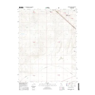
2015 Map of Kirkwood Spring
USGS Topo · Published 2015About this map
Brawley Peaks and the high elevations of the Bodie Mountains dominate this high-desert landscape along the border of California and Nevada. In the southern portion of the quadrangle, Kirkwood Spring serves as a vital water source in an otherwise arid terrain, situated near the junction of Dobie Meadow Rd. The map illustrates a remote territory managed largely by the Toiyabe National Forest, where historical access routes like Bodie Rd navigate the steep topography near Bodie Cr. To the east, the descent into Trench Canyon highlights the dramatic verticality of the region. This 2015 survey provides a modern record of these classic Great Basin landmarks, tracing the township and range lines that have defined these remote Mono County reaches since the early settlement era.
Find a feature on this map
16 named features on this map. Tap any name to fly to it.
Don’t see what you’re looking for? This feature index may not catch every label — zoom into the map to look around manually.
Map Details
Editions of this 2015 Kirkwood Spring Map
This is the sole edition of this map. No revisions or reprints were ever made.
Other maps of this area

1909 · Hawthorne
USGS Topo · 1:250,000

1909 · Bridgeport
USGS Topo · 1:125,000

1911 · Bridgeport
USGS Topo · 1:125,000

1911 · Hawthorne
USGS Topo · 1:250,000

1915 · Hawthorne
USGS Topo · 1:250,000

1920 · Bridgeport
USGS Topo · 1:125,000

1948 · Walker Lake
USGS Topo · 1:250,000

1956 · Aurora
USGS Topo · 1:62,500

1957 · Walker Lake
USGS Topo · 1:250,000

1958 · Bodie
USGS Topo · 1:62,500