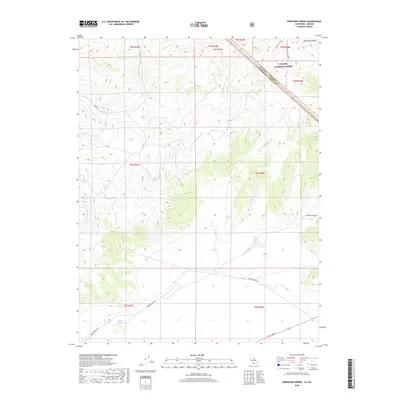
2018 Map of Kirkwood Spring
USGS Topo · Published 2018About this map
Kirkwood Spring serves as a vital water source in this arid high-altitude landscape along the border of California and Nevada. Located within the Toiyabe National Forest, the terrain is defined by the sharp elevations of the Bodie Mountains and the prominent Braly Peaks. This 2018 survey reveals a network of historical routes and backcountry access points that have long supported mining and ranching interests in Mono County.
Find a feature on this map
18 named features on this map. Tap any name to fly to it.
Don’t see what you’re looking for? This feature index may not catch every label — zoom into the map to look around manually.
Map Details
Editions of this 2018 Kirkwood Spring Map
This is the sole edition of this map. No revisions or reprints were ever made.
Other maps of this area

1909 · Hawthorne
USGS Topo · 1:250,000

1909 · Bridgeport
USGS Topo · 1:125,000

1911 · Bridgeport
USGS Topo · 1:125,000

1911 · Hawthorne
USGS Topo · 1:250,000

1915 · Hawthorne
USGS Topo · 1:250,000

1920 · Bridgeport
USGS Topo · 1:125,000

1948 · Walker Lake
USGS Topo · 1:250,000

1956 · Aurora
USGS Topo · 1:62,500

1957 · Walker Lake
USGS Topo · 1:250,000

1958 · Bodie
USGS Topo · 1:62,500