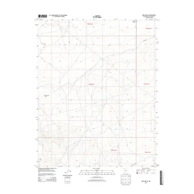
2013 Map of Kirtland SE
USGS Topo · Published 2013About this map
Ojo Amarillo Canyon dominates the northern reaches of this high-desert landscape in San Juan County, illustrating the intricate drainage patterns that define this section of the Shiprock Agency. The terrain is marked by the seasonal path of the Cottonwood Arroyo, which snakes through the western portion of the quadrangle. This 2013 survey documents a remote geography primarily organized by a network of rural routes, including Indian Route 4050 and Ind Road 4045. The map provides a detailed view of the Public Land Survey System grid, specifically within townships such as t27n r14w and t28n r14w, showing how these administrative boundaries overlay the natural topography of canyons and washes near the Colorado border.
Find a feature on this map
11 named features on this map. Tap any name to fly to it.
Don’t see what you’re looking for? This feature index may not catch every label — zoom into the map to look around manually.
Map Details
Editions of this 2013 Kirtland SE Map
This is the sole edition of this map. No revisions or reprints were ever made.
Other maps of this area

1889 · Chaco
USGS Topo · 1:250,000

1892 · Chaco
USGS Topo · 1:250,000

1927 · Sulphur Spring
USGS Topo · 1:96,000

1928 · Kirtland
USGS Topo · 1:125,000

1932 · Kirtland
USGS Topo · 1:125,000

1954 · Shiprock
USGS Topo · 1:250,000

1958 · Shiprock
USGS Topo · 1:250,000

1959 · Shiprock
USGS Topo · 1:250,000
1965 · Farmington South
USGS Topo · 1:24,000
1965 · Hugh Lake
USGS Topo · 1:24,000