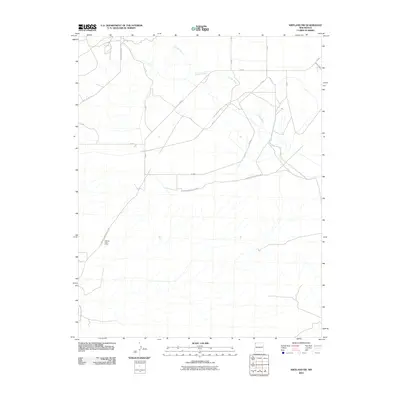
2010 Map of Kirtland SW
USGS Topo · Published 2010About this map
Cebolla Post Office stands as a primary landmark in this corner of the Shiprock Agency, situated along an extensive network of service roads and desert tracks. The landscape is defined by the drainage of Chinde Wash, which meanders through the northern section of the quadrangle. The infrastructure reflects the administrative and residential patterns of the Navajo Nation, with numerous numbered routes such as Indian Service Route 5085 and Yazzie Skyline Rd providing access across the arid terrain. This 2010 survey illustrates the modern transportation grid connecting small community hubs and rural homesteads in San Juan County, where the desert floor is etched by both natural washes and the maintained pathways of the Bureau of Indian Affairs road system.
Find a feature on this map
15 named features on this map. Tap any name to fly to it.
Don’t see what you’re looking for? This feature index may not catch every label — zoom into the map to look around manually.
Map Details
Editions of this 2010 Kirtland SW Map
This is the sole edition of this map. No revisions or reprints were ever made.
Other maps of this area

1889 · Chaco
USGS Topo · 1:250,000

1892 · Chaco
USGS Topo · 1:250,000

1927 · Sulphur Spring
USGS Topo · 1:96,000

1928 · Kirtland
USGS Topo · 1:125,000

1932 · Kirtland
USGS Topo · 1:125,000

1954 · Shiprock
USGS Topo · 1:250,000

1958 · Shiprock
USGS Topo · 1:250,000

1959 · Shiprock
USGS Topo · 1:250,000
1966 · The Hogback North
USGS Topo · 1:24,000
1966 · Newcomb NE
USGS Topo · 1:24,000