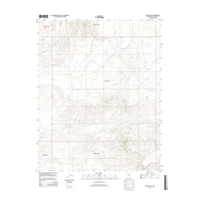
2013 Map of Kirtland SW
USGS Topo · Published 2013About this map
Chinde Wash traverses the northern reaches of this New Mexico landscape, cutting through an arid terrain defined by the complex drainage patterns of the Shiprock Agency region. This 2013 survey by the U.S. Geological Survey provides a precise view of the high desert topography, where water sources like Cottonwood Springs and various unnamed Springs dictate the local geography. The presence of Yazzie Skyline Rd in the northwestern corner suggests the intersection of traditional land use with modern access routes. This area remains largely defined by its natural hydrology and the established Public Land Survey System grids, visible through township and range boundaries like t27n r15w.
Find a feature on this map
9 named features on this map. Tap any name to fly to it.
Don’t see what you’re looking for? This feature index may not catch every label — zoom into the map to look around manually.
Map Details
Editions of this 2013 Kirtland SW Map
This is the sole edition of this map. No revisions or reprints were ever made.
Other maps of this area

1889 · Chaco
USGS Topo · 1:250,000

1892 · Chaco
USGS Topo · 1:250,000

1927 · Sulphur Spring
USGS Topo · 1:96,000

1928 · Kirtland
USGS Topo · 1:125,000

1932 · Kirtland
USGS Topo · 1:125,000

1954 · Shiprock
USGS Topo · 1:250,000

1958 · Shiprock
USGS Topo · 1:250,000

1959 · Shiprock
USGS Topo · 1:250,000
1966 · The Hogback North
USGS Topo · 1:24,000
1966 · Newcomb NE
USGS Topo · 1:24,000