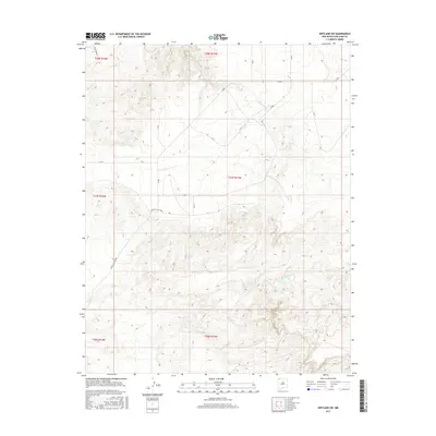
2017 Map of Kirtland SW
USGS Topo · Published 2017About this map
Chinde Wash meanders across this high-desert landscape in the Shiprock Agency region, defining the drainage patterns of an area dominated by intricate topographical relief. The map reveals a specialized network of Bureau of Indian Affairs and service roads, including Indian Svc Rte 5085 and various numerical routes like N 3005 and N 411. These corridors provide access through the complex terrain, connecting localized water sources such as Cottonwood Springs and the uniquely identified 13R-104 Spring. The presence of the Pinto Reroute suggests evolving infrastructure within these tribal lands. This survey serves as a precise record of the physical geography and road designations during the late 2010s, illustrating how modern transportation routes are etched into the ancient, arid landforms of San Juan County.
Find a feature on this map
21 named features on this map. Tap any name to fly to it.
Don’t see what you’re looking for? This feature index may not catch every label — zoom into the map to look around manually.
Map Details
Editions of this 2017 Kirtland SW Map
This is the sole edition of this map. No revisions or reprints were ever made.
Other maps of this area

1889 · Chaco
USGS Topo · 1:250,000

1892 · Chaco
USGS Topo · 1:250,000

1927 · Sulphur Spring
USGS Topo · 1:96,000

1928 · Kirtland
USGS Topo · 1:125,000

1932 · Kirtland
USGS Topo · 1:125,000

1954 · Shiprock
USGS Topo · 1:250,000

1958 · Shiprock
USGS Topo · 1:250,000

1959 · Shiprock
USGS Topo · 1:250,000
1966 · The Hogback North
USGS Topo · 1:24,000
1966 · Newcomb NE
USGS Topo · 1:24,000