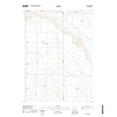
2021 Map of Kirtley
USGS Topo · Published 2021About this map
Kirtley sits on the western edge of this High Plains landscape, where the state line divides the ranch lands of eastern Wyoming from the panhandle of Nebraska. This 2021 survey documents a region defined by its drainage systems and ridge lines, most notably the Pleasant Ridge which trends through the southern half of the quadrangle. Genealogists and local historians will find the Pleasant Ridge Pioneer Cem centrally located, serving as a quiet landmark of early settlement in this corner of Sioux County. To the north, the terrain rises toward Turner Peak, while the network of creeks including Squaw Cr, Dirty Jim Cr, and the branches of S Antelope Cr carve deep into the plateau. The map details the rural infrastructure connecting these points, from Klondike Rd to the long stretches of N Van Tassell Rd.
Find a feature on this map
30 named features on this map. Tap any name to fly to it.
Don’t see what you’re looking for? This feature index may not catch every label — zoom into the map to look around manually.
Map Details
Editions of this 2021 Kirtley Map
This is the sole edition of this map. No revisions or reprints were ever made.
Other maps of this area

1954 · Torrington
USGS Topo · 1:250,000

1955 · Alliance
USGS Topo · 1:250,000

1957 · Alliance
USGS Topo · 1:250,000

1958 · Torrington
USGS Topo · 1:250,000

1958 · Alliance
USGS Topo · 1:250,000

1974 · Mc Master Reservoir
USGS Topo · 1:24,000

1977 · Van Tassell
USGS Topo · 1:24,000

1978 · Shepherds Point
USGS Topo · 1:24,000

1978 · Kirtley SW
USGS Topo · 1:24,000

1978 · Harrison West
USGS Topo · 1:24,000