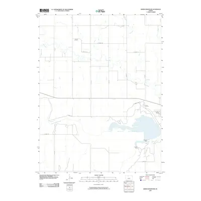
2009 Map of Kirwin Reservoir
USGS Topo · Published 2009About this map
Kirwin sits at the edge of the expansive Kirwin Reservoir in Phillips County, marking a landscape where the North Fork Solomon River was harnessed for water management and recreation. The settlement pattern is defined by a rigorous section-line road grid, including E Thunder Rd and E 900 Rd, which segments the rural acreage north of the water. This grid is interrupted only by the meandering paths of Deer Creek, Big Creek, and Plum Creek, which drain toward the reservoir basin.
Find a feature on this map
25 named features on this map. Tap any name to fly to it.
Don’t see what you’re looking for? This feature index may not catch every label — zoom into the map to look around manually.
Map Details
Editions of this 2009 Kirwin Reservoir Map
This is the sole edition of this map. No revisions or reprints were ever made.
Other maps of this area

1893 · Phillipsburg
USGS Topo · 1:125,000

1955 · Beloit
USGS Topo · 1:250,000

1959 · Beloit
USGS Topo · 1:250,000

1961 · Kirwin SE
USGS Topo · 1:24,000

1961 · Kirwin SW
USGS Topo · 1:24,000

1972 · Kirwin
USGS Topo · 1:24,000

1972 · Kirwin Reservoir
USGS Topo · 1:24,000

1972 · Phillipsburg South
USGS Topo · 1:24,000
1972 · Glade SE
USGS Topo · 1:24,000

1973 · Kensington
USGS Topo · 1:24,000