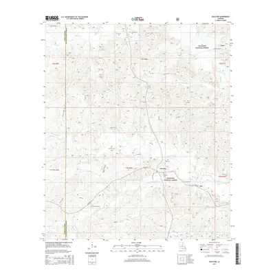
2015 Map of Kisatchie
USGS Topo · Published 2015About this map
Kisatchie Bayou and its numerous tributaries, including Little Sandy Creek, carve through the center of this landscape within the Kisatchie National Forest. The settlement of Kisatchie serves as a local focal point near the parish line, surrounded by a high concentration of family and community burial grounds such as the Old Kisatchie Cem and New Kisatchie Cem. This 2015 survey reveals a terrain defined by water and woods, where local landmarks like Kisatchie Fall and Odom Falls highlight the area's natural drainage patterns.
Find a feature on this map
64 named features on this map. Tap any name to fly to it.
Don’t see what you’re looking for? This feature index may not catch every label — zoom into the map to look around manually.
Map Details
Editions of this 2015 Kisatchie Map
This is the sole edition of this map. No revisions or reprints were ever made.
Other maps of this area

1937 · Bellwood
USGS Topo · 1:31,680

1937 · Cypress
USGS Topo · 1:31,680

1942 · Many
USGS Topo · 1:62,500

1942 · Florien
USGS Topo · 1:62,500

1942 · Kisatchie
USGS Topo · 1:62,500

1943 · Many
USGS Topo · 1:62,500

1943 · Kisatchie
USGS Topo · 1:62,500

1943 · Provencal
USGS Topo · 1:62,500

1944 · Florien
USGS Topo · 1:62,500

1945 · Provencal
USGS Topo · 1:62,500