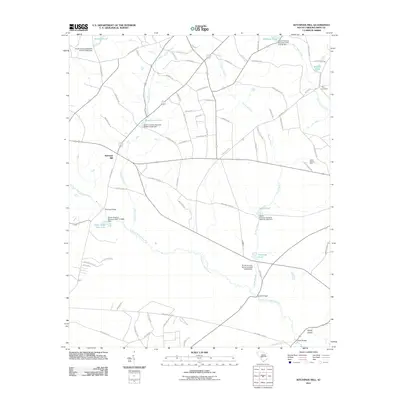
2011 Map of Kitchings Mill
USGS Topo · Published 2011About this map
The South Fork Edisto River meanders through this landscape, defining the character of the region southeast of Aiken. The map showcases a dense network of water features, including Baughmans Pond, Tylers Pond, and Brodies Pond, many of which are associated with named dams. This hydrography supported early industry, as evidenced by Kitchings Mill, a primary settlement point on the western edge. In the southwestern corner, Aiken State Park encompasses a significant portion of the riverbank, including Aiken State Park Lake. Notable for genealogists is the Tyler Cemetery in the northeast, while localized agricultural operations like the Trinity Poultry Farm indicate the rural economy of the early 21st century. River crossings such as Pine Log Bridge and Keadle Bridge remain essential landmarks along the winding watercourse.
Find a feature on this map
81 named features on this map. Tap any name to fly to it.
Don’t see what you’re looking for? This feature index may not catch every label — zoom into the map to look around manually.
Map Details
Editions of this 2011 Kitchings Mill Map
This is the sole edition of this map. No revisions or reprints were ever made.
Other maps of this area

1920 · Aiken
USGS Topo · 1:48,000

1920 · Talatha
USGS Topo · 1:48,000

1921 · Aiken
USGS Topo · 1:62,500

1921 · Talatha
USGS Topo · 1:62,500

1923 · Williston
USGS Topo · 1:48,000

1927 · Williston
USGS Topo · 1:62,500

1943 · Aiken
USGS Topo · 1:62,500

1943 · Augusta East
USGS Topo · 1:125,000

1943 · Williston
USGS Topo · 1:62,500

1943 · Talatha
USGS Topo · 1:62,500