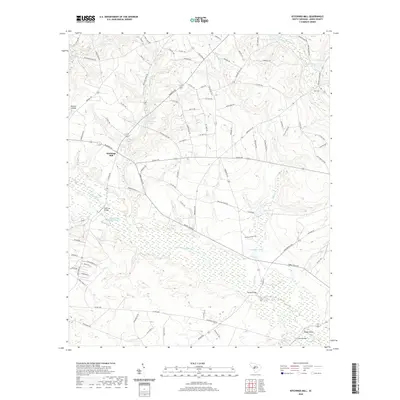
2020 Map of Kitchings Mill
USGS Topo · Published 2020About this map
S Fork Edisto River winds through the heart of this Aiken County landscape, defining the wetland corridors and low-lying topography of the region. The map reveals a pattern of rural life structured around water and wood, with several crossings such as Pine Log Bridge, Keadle Bridge, and Davis Bridge providing vital links across the river and its tributaries. To the west, Aiken State Park and the Aiken State Park Lake serve as major recreational landmarks, while smaller agricultural and residential settlements like Kitchings Mill and Wexford Landing dot the higher ground.
Find a feature on this map
98 named features on this map. Tap any name to fly to it.
Don’t see what you’re looking for? This feature index may not catch every label — zoom into the map to look around manually.
Map Details
Editions of this 2020 Kitchings Mill Map
This is the sole edition of this map. No revisions or reprints were ever made.
Other maps of this area

1920 · Aiken
USGS Topo · 1:48,000

1920 · Talatha
USGS Topo · 1:48,000

1921 · Aiken
USGS Topo · 1:62,500

1921 · Talatha
USGS Topo · 1:62,500

1923 · Williston
USGS Topo · 1:48,000

1927 · Williston
USGS Topo · 1:62,500

1943 · Aiken
USGS Topo · 1:62,500

1943 · Augusta East
USGS Topo · 1:125,000

1943 · Williston
USGS Topo · 1:62,500

1943 · Talatha
USGS Topo · 1:62,500