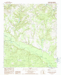
1988 Map of Kitchings Mill
USGS Topo · Published 1988About this map
The South Fork Edisto River meanders through the heart of this Aiken County landscape, defining much of the local topography and drainage patterns. The settlement of Kitchings Mill serves as a primary geographic anchor in the northwest, situated near the headwaters of Burcalo Creek. The map reveals a dense network of water features and impoundments, including Baughmans Pond, Gardins Pond, and Tylers Pond, which suggest a long history of water management for agricultural or milling purposes in this coastal plain environment.
Find a feature on this map
16 named features on this map. Tap any name to fly to it.
Don’t see what you’re looking for? This feature index may not catch every label — zoom into the map to look around manually.
Map Details
Editions of this 1988 Kitchings Mill Map
This is the sole edition of this map. No revisions or reprints were ever made.
Other maps of this area

1920 · Aiken
USGS Topo · 1:48,000

1920 · Talatha
USGS Topo · 1:48,000

1921 · Aiken
USGS Topo · 1:62,500

1921 · Talatha
USGS Topo · 1:62,500

1923 · Williston
USGS Topo · 1:48,000

1927 · Williston
USGS Topo · 1:62,500

1943 · Aiken
USGS Topo · 1:62,500

1943 · Augusta East
USGS Topo · 1:125,000

1943 · Williston
USGS Topo · 1:62,500

1943 · Talatha
USGS Topo · 1:62,500