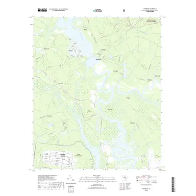
2020 Map of Kittredge
USGS Topo · Published 2020About this map
The West Branch Cooper River and East Branch Cooper River converge here to form the Cooper River, a landscape defined by its deep tidal history and plantation heritage. Several notable burial grounds, including the Strawberry Chapel Cem and Parnassus Plantation Cem, are positioned near the riverbanks, marking the sites of early estates. The northern portion of the map is dominated by the Francis Marion National Forest and the Mepkin area, while the southern reach includes the expanding industrial and military presence of NWS Charleston near Goose Creek. Wetland systems such as Sophia Swamp and Chipper Swamp remain largely intact between established settlements like Rice Hope, Comingtee, and Richmond, illustrating the enduring Lowcountry topography of the Berkeley County region.
Find a feature on this map
103 named features on this map. Tap any name to fly to it.
Don’t see what you’re looking for? This feature index may not catch every label — zoom into the map to look around manually.
Map Details
Editions of this 2020 Kittredge Map
This is the sole edition of this map. No revisions or reprints were ever made.
Other maps of this area

1919 · Ladson
USGS Topo · 1:21,120

1919 · Summerville
USGS Topo · 1:48,000

1919 · Wando
USGS Topo · 1:21,120

1919 · Cordesville
USGS Topo · 1:48,000

1919 · Melgrove
USGS Topo · 1:21,120

1920 · Ravenels
USGS Topo · 1:62,500

1920 · Summerville
USGS Topo · 1:62,500

1940 · Melgrove
USGS Topo · 1:24,000

1943 · Wando
USGS Topo · 1:24,000

1943 · Ladson
USGS Topo · 1:24,000