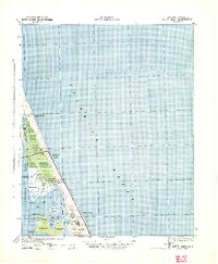
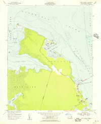
1940 Map of Kitty Hawk
USGS Topo · Published 1940About this map
Wright Memorial Monument 151 stands as a focal point on the shifting sands of the Outer Banks during the early 1940s. This survey, produced by the Corps of Engineers, U.S. Army, documents the coastal landscape at a time when the area was characterized by small settlements and maritime infrastructure. The geography is defined by the thin barrier between the Atlantic Ocean and Currituck Sound, with the village of Kitty Hawk and the nearby Kitty Hawk Beach serving as primary landmarks.
Find a feature on this map
28 named features on this map. Tap any name to fly to it.
Don’t see what you’re looking for? This feature index may not catch every label — zoom into the map to look around manually.
Map Details
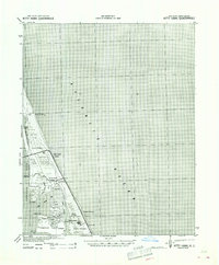
Editions of this 1940 Kitty Hawk Map
2 editions found
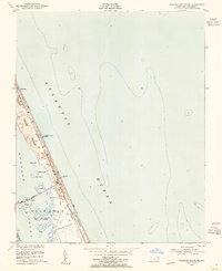
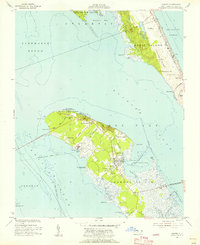
Other maps of this area

1940 · Barco
USGS Topo · 1:62,500
1940 · Kitty Hawk
USGS Topo · 1:62,500

1940 · Powells Point
USGS Topo · 1:62,500

1943 · Roanoke Island
USGS Topo · 1:125,000

1946 · Eastville
USGS Topo · 1:250,000

1946 · Currituck Sound
USGS Topo · 1:250,000
1953 · Roanoke Island NE
USGS Topo · 1:24,000
1953 · Manteo
USGS Topo · 1:24,000
1953 · Manns Harbor
USGS Topo · 1:24,000
1955 · Wanchese
USGS Topo · 1:250,000