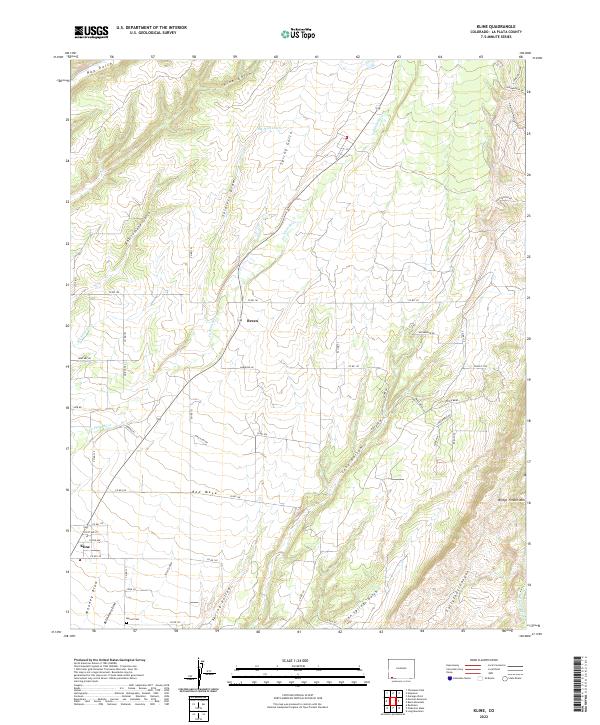
2022 Map of Kline
USGS Topo · Published 2022About this map
Breen and Kline anchor the agricultural and ranching landscape of southwestern La Plata County, situated within a complex network of canyons and gulches. The terrain is defined by the course of the La Plata River and its varied drainage systems, including McDermott Arroyo and Long Hollow. These natural features are interspersed with irrigation efforts like the Big Stick Ditch, essential for the high-plateau environment. To the south, the Marvel Cem provides a specific point of interest for genealogists tracing family histories in the Red Mesa area. This 2022 survey details the modern road network, featuring local connectors such as Co RD 141 and Mira Mesa Dr, which navigate the elevation changes near Bridge Timber Mtn. The map clearly illustrates how contemporary settlement patterns continue to follow the traditional canyon and ridge topography of the region.
Find a feature on this map
63 named features on this map. Tap any name to fly to it.
Don’t see what you’re looking for? This feature index may not catch every label — zoom into the map to look around manually.
Map Details
Editions of this 2022 Kline Map
This is the sole edition of this map. No revisions or reprints were ever made.
Other maps of this area

1895 · La Plata
USGS Topo · 1:62,500

1897 · La Plata
USGS Topo · 1:62,500

1898 · Durango
USGS Topo · 1:62,500

1899 · La Plata
USGS Topo · 1:62,500

1907 · Durango
USGS Topo · 1:62,500

1908 · Ignacio
USGS Topo · 1:125,000

1908 · Durango
USGS Topo · 1:62,500

1908 · La Plata
USGS Topo · 1:62,500

1913 · Red Mesa
USGS Topo · 1:62,500

1924 · Ignacio
USGS Topo · 1:125,000