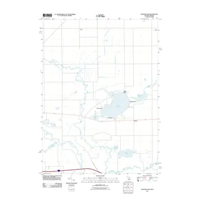
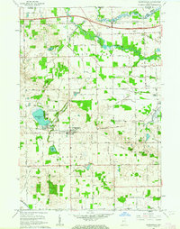
2011 Map of Klinger Lake
USGS Topo · Published 2011About this map
Klinger Lake serves as the central focal point of this recreational and residential landscape in southern Michigan, surrounded by established lakeside communities like Bluff Beach, Sandy Beach, Breezy Beach, and Oakwood. The drainage patterns of the region are defined by the meandering Fawn River and the Pigeon River, which weave through a glacial terrain dotted with smaller water bodies such as Tamarack Lake, Grass Lake, and Devils Hole.
Find a feature on this map
22 named features on this map. Tap any name to fly to it.
Don’t see what you’re looking for? This feature index may not catch every label — zoom into the map to look around manually.
Map Details
Editions of this 2011 Klinger Lake Map
This is the sole edition of this map. No revisions or reprints were ever made.
Other maps of this area

1914 · Three Rivers
USGS Topo · 1:62,500

1916 · Three Rivers
USGS Topo · 1:62,500

1943 · Three Rivers
USGS Topo · 1:62,500

1947 · Lagrange
USGS Topo · 1:24,000

1953 · Fort Wayne
USGS Topo · 1:250,000

1956 · Fort Wayne
USGS Topo · 1:250,000
1960 · Lagrange
USGS Topo · 1:24,000
1961 · Sturgis
USGS Topo · 1:24,000
1961 · Nottawa
USGS Topo · 1:24,000
1961 · Shipshewana
USGS Topo · 1:24,000