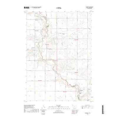
2018 Map of Klondike
USGS Topo · Published 2018About this map
The Big Sioux River serves as the primary geographical divider between Iowa and South Dakota, winding through a landscape of creek valleys and agricultural uplands. The settlement of Klondike is situated at a key crossing point in the southeast, anchored by the Klondike Bridge and the nearby Klondike Cr. Further north along the state line, the community of Granite is positioned near the junction of Blood Run and the river, an area defined by its proximity to the historic borderlands.
Find a feature on this map
53 named features on this map. Tap any name to fly to it.
Don’t see what you’re looking for? This feature index may not catch every label — zoom into the map to look around manually.
Map Details
Editions of this 2018 Klondike Map
This is the sole edition of this map. No revisions or reprints were ever made.
Other maps of this area

1897 · Canton
USGS Topo · 1:125,000

1900 · Canton
USGS Topo · 1:125,000

1955 · Sioux Falls
USGS Topo · 1:250,000

1958 · Sioux Falls
USGS Topo · 1:250,000

1962 · Klondike
USGS Topo · 1:24,000

1962 · Harrisburg
USGS Topo · 1:24,000

1962 · Canton
USGS Topo · 1:24,000

1962 · Brandon
USGS Topo · 1:24,000

1962 · Sioux Falls East
USGS Topo · 1:24,000

1964 · Canton SW
USGS Topo · 1:24,000