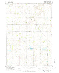
1978 Map of Kloucek Lake
USGS Topo · Published 1979About this map
The agricultural landscape of Scotland and Lincoln townships is defined by a grid of farm sections and the diagonal path of the Chicago Milwaukee St Paul and Pacific railroad. This 1970s survey captures a transition in the rural economy, where section lines are dotted with established homesteads, specialized Gravel Pits, and a prominent Radio Tower. The terrain is marked by the winding courses of Prairie Creek and Beaver Creek, which feed into the central Kloucek Lake.
Find a feature on this map
14 named features on this map. Tap any name to fly to it.
Don’t see what you’re looking for? This feature index may not catch every label — zoom into the map to look around manually.
Map Details
Editions of this 1978 Kloucek Lake Map
This is the sole edition of this map. No revisions or reprints were ever made.
Other maps of this area

1898 · Olivet
USGS Topo · 1:125,000

1955 · Sioux City
USGS Topo · 1:250,000

1955 · Sioux Falls
USGS Topo · 1:250,000

1957 · Menno
USGS Topo · 1:24,000

1957 · Scotland
USGS Topo · 1:24,000

1958 · Sioux City
USGS Topo · 1:250,000

1958 · Sioux Falls
USGS Topo · 1:250,000

1959 · Sioux City
USGS Topo · 1:250,000

1978 · Tripp SE
USGS Topo · 1:24,000
1978 · Tabor NE
USGS Topo · 1:24,000
Featured Places
- Odessa Township, SD
- Scotland Township, SD
- Lesterville Township, SD
- Lincoln Township, SD
- Yankton County, SD