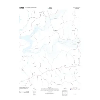
2013 Map of Knifley
USGS Topo · Published 2013About this map
Knifley serves as a central hub in this Adair County landscape, where the northern waters of Green River Lake meet a network of rural ridges and creek valleys. The terrain is defined by prominent elevations such as Dunbar Hill and Robinson Ridge, which divide the drainages of Casey Cr and Spout Springs Br. Small settlements and historic communities are scattered throughout the area, including Purdy, Christine, and Ella, each connected by a winding web of named local routes like Redie Tucker Rd and Christine Sand Rd. Family history and local heritage are well-preserved through numerous small burial grounds, including Parker Chapel Cem, Damron Cem, and Allen Cem. The map illustrates a contemporary rural Kentucky environment where agricultural life follows the natural contours of the land, centered around the Green River and its many tributaries.
Find a feature on this map
102 named features on this map. Tap any name to fly to it.
Don’t see what you’re looking for? This feature index may not catch every label — zoom into the map to look around manually.
Map Details
Editions of this 2013 Knifley Map
This is the sole edition of this map. No revisions or reprints were ever made.
Other maps of this area

1952 · Clementsville
USGS Topo · 1:24,000

1952 · Mannsville
USGS Topo · 1:24,000

1953 · Campbellsville
USGS Topo · 1:24,000

1953 · Montpelier
USGS Topo · 1:24,000

1953 · Dunnville
USGS Topo · 1:24,000

1953 · Cane Valley
USGS Topo · 1:24,000

1954 · Knifley
USGS Topo · 1:24,000

1954 · Columbia
USGS Topo · 1:24,000

1954 · Russell Springs
USGS Topo · 1:24,000

1957 · Winchester
USGS Topo · 1:250,000