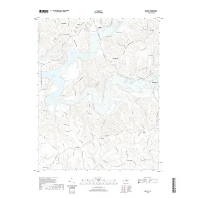
2019 Map of Knifley
USGS Topo · Published 2019About this map
Green River Lake dominates this northern Adair County landscape, where the waters of the Green River and Casey Creek meet. The terrain is defined by a dense network of high ground, including Hovious Ridge, Robinson Ridge, and Camel Ridge, which separate the various creek branches that feed the central reservoir. Small rural settlements like Knifley, Purdy, and Christine are linked by a complex web of backroads such as Union Church Rd and Little Cake Rd.
Find a feature on this map
96 named features on this map. Tap any name to fly to it.
Don’t see what you’re looking for? This feature index may not catch every label — zoom into the map to look around manually.
Map Details
Editions of this 2019 Knifley Map
This is the sole edition of this map. No revisions or reprints were ever made.
Other maps of this area

1952 · Clementsville
USGS Topo · 1:24,000

1952 · Mannsville
USGS Topo · 1:24,000

1953 · Campbellsville
USGS Topo · 1:24,000

1953 · Montpelier
USGS Topo · 1:24,000

1953 · Dunnville
USGS Topo · 1:24,000

1953 · Cane Valley
USGS Topo · 1:24,000

1954 · Knifley
USGS Topo · 1:24,000

1954 · Columbia
USGS Topo · 1:24,000

1954 · Russell Springs
USGS Topo · 1:24,000

1957 · Winchester
USGS Topo · 1:250,000