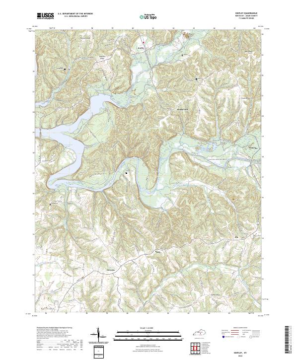
2022 Map of Knifley
USGS Topo · Published 2022About this map
Knifley and the surrounding Adair County uplands are defined by the intricate finger-like extensions of Green River Lake, where the impounded waters of Casey Creek and the Green River branch into deep hollows. This 2022 survey illustrates a landscape of high ridges and narrow valleys, where small settlements like Purdy, Christine, and Ella are connected by a network of winding ridge-top roads. The terrain is notably dissected, featuring landmarks such as Hovious Ridge, Robinson Ridge, and Camel Ridge.
Find a feature on this map
104 named features on this map. Tap any name to fly to it.
Don’t see what you’re looking for? This feature index may not catch every label — zoom into the map to look around manually.
Map Details
Editions of this 2022 Knifley Map
This is the sole edition of this map. No revisions or reprints were ever made.
Other maps of this area

1952 · Clementsville
USGS Topo · 1:24,000

1952 · Mannsville
USGS Topo · 1:24,000

1953 · Campbellsville
USGS Topo · 1:24,000

1953 · Montpelier
USGS Topo · 1:24,000

1953 · Dunnville
USGS Topo · 1:24,000

1953 · Cane Valley
USGS Topo · 1:24,000

1954 · Knifley
USGS Topo · 1:24,000

1954 · Columbia
USGS Topo · 1:24,000

1954 · Russell Springs
USGS Topo · 1:24,000

1957 · Winchester
USGS Topo · 1:250,000