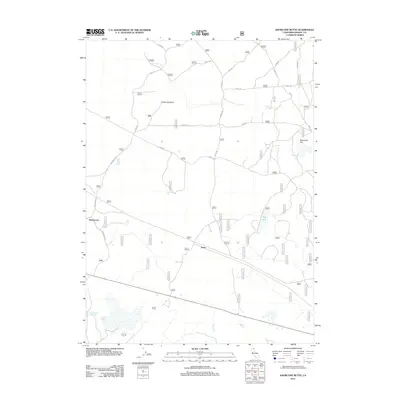
2012 Map of Knobcone Butte
USGS Topo · Published 2012About this map
Knobcone Butte rises above a high-desert landscape in northern California, where the sparse settlements of Hackamore and Boles anchor a network of forest service roads. This 2012 survey shows a region defined by its water management and grazing infrastructure, featuring numerous named catchments such as Sorholus Tank and the uniquely named Wart on Tree Tank. The terrain transitions from the volcanic heights of the butte down to Stovepipe Flat and the depressions of Hog Lake and Beeler Reservoir. The map provides a detailed look at the rural logistics of Modoc County, tracing the paths of Turner Cr and seasonal water sources like North Spring and Deer Spring. A dense grid of numeric forest routes, such as 43n77 and 44n11, reveals the managed nature of these public lands for transit and resource access.
Find a feature on this map
66 named features on this map. Tap any name to fly to it.
Don’t see what you’re looking for? This feature index may not catch every label — zoom into the map to look around manually.
Map Details
Editions of this 2012 Knobcone Butte Map
This is the sole edition of this map. No revisions or reprints were ever made.
Other maps of this area

1886 · Alturas
USGS Topo · 1:250,000

1886 · Modoc Lava Bed
USGS Topo · 1:250,000

1892 · Modoc Lava-Bed
USGS Topo · 1:250,000

1892 · Alturas
USGS Topo · 1:250,000

1952 · Hackamore
USGS Topo · 1:62,500

1954 · Alturas
USGS Topo · 1:250,000

1958 · Alturas
USGS Topo · 1:250,000

1961 · Canby
USGS Topo · 1:62,500

1962 · Alturas
USGS Topo · 1:250,000

1962 · Crank Mountain
USGS Topo · 1:62,500