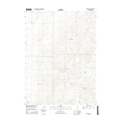
2015 Map of Knott Creek
USGS Topo · Published 2015About this map
Pine Forest Range rises sharply above the high desert floor in this detailed 2015 study of the northern Nevada interior. The landscape is defined by its drainages and water management, featuring Knott Creek Reservoir and Little Onion Reservoir tucked into the mountain folds. These alpine catchments feed an intricate network of seasonal flows, including Knott Creek, Cow Creek, and Alder Creek, which descend toward the basin below.
Find a feature on this map
18 named features on this map. Tap any name to fly to it.
Don’t see what you’re looking for? This feature index may not catch every label — zoom into the map to look around manually.
Map Details
Editions of this 2015 Knott Creek Map
This is the sole edition of this map. No revisions or reprints were ever made.
Other maps of this area

1886 · Disaster
USGS Topo · 1:250,000

1893 · Disaster
USGS Topo · 1:250,000

1954 · Vya
USGS Topo · 1:250,000

1958 · Vya
USGS Topo · 1:250,000

1962 · Vya
USGS Topo · 1:250,000

1965 · Railroad Point
USGS Topo · 1:62,500

1965 · Idaho Canyon
USGS Topo · 1:62,500

1965 · Duffer Peak
USGS Topo · 1:62,500

1966 · Denio
USGS Topo · 1:62,500

1979 · Denio
USGS Topo · 1:100,000