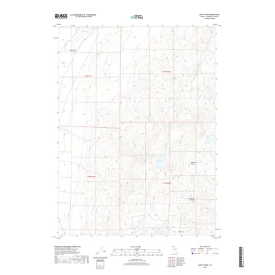
2018 Map of Knott Creek
USGS Topo · Published 2018About this map
The Pine Forest Range dominates this corner of Humboldt County, defining a landscape of high-elevation meadows and seasonal water systems. In the southern portion of the quadrangle, Hollywood Meadow and Rodeo Flat represent the specialized grazing and gathering grounds utilized in this high-desert environment. The drainage patterns are particularly intricate, with Knott Cr feeding into the Knott Creek Reservoir before transitioning into the Knott Cr Channel. This area illustrates the essential management of water in the Great Basin, where features like Gridley Springs and the ephemeral Gridley Lake provided critical points of interest for early travelers and ranching operations. The terrain shifts from the peaks of the range down to the low-lying Alkali Flat, showcasing the stark elevation changes typical of the Nevada interior.
Find a feature on this map
18 named features on this map. Tap any name to fly to it.
Don’t see what you’re looking for? This feature index may not catch every label — zoom into the map to look around manually.
Map Details
Editions of this 2018 Knott Creek Map
This is the sole edition of this map. No revisions or reprints were ever made.
Other maps of this area

1886 · Disaster
USGS Topo · 1:250,000

1893 · Disaster
USGS Topo · 1:250,000

1954 · Vya
USGS Topo · 1:250,000

1958 · Vya
USGS Topo · 1:250,000

1962 · Vya
USGS Topo · 1:250,000

1965 · Railroad Point
USGS Topo · 1:62,500

1965 · Idaho Canyon
USGS Topo · 1:62,500

1965 · Duffer Peak
USGS Topo · 1:62,500

1966 · Denio
USGS Topo · 1:62,500

1979 · Denio
USGS Topo · 1:100,000