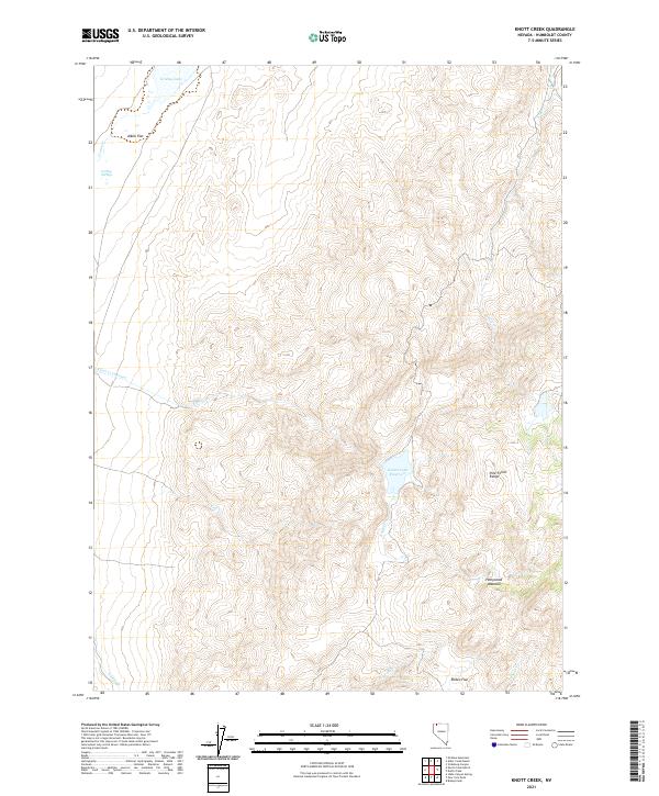
2021 Map of Knott Creek
USGS Topo · Published 2021About this map
Knott Creek Reservoir serves as a central hydrological landmark within the high-elevation basin of the Pine Forest Range. The landscape is defined by the sharp contrast between the seasonal waters of Gridley Lake and the arid expanse of the Alkali Flat to the northwest. This modern survey illustrates a network of drainage systems including Knott Creek, Craine Creek, and Alder Creek that feed into the local flats and meadows. Local history and ranching patterns are suggested by the presence of Hollywood Meadow and Rodeo Flat, which indicate the traditional use of these upland terraces for grazing. The topographic detail captures the steep elevations surrounding Gridley Springs, providing a clear view of the water resources essential for survival in this part of Humboldt County.
Find a feature on this map
18 named features on this map. Tap any name to fly to it.
Don’t see what you’re looking for? This feature index may not catch every label — zoom into the map to look around manually.
Map Details
Editions of this 2021 Knott Creek Map
This is the sole edition of this map. No revisions or reprints were ever made.
Other maps of this area

1886 · Disaster
USGS Topo · 1:250,000

1893 · Disaster
USGS Topo · 1:250,000

1954 · Vya
USGS Topo · 1:250,000

1958 · Vya
USGS Topo · 1:250,000

1962 · Vya
USGS Topo · 1:250,000

1965 · Railroad Point
USGS Topo · 1:62,500

1965 · Idaho Canyon
USGS Topo · 1:62,500

1965 · Duffer Peak
USGS Topo · 1:62,500

1966 · Denio
USGS Topo · 1:62,500

1979 · Denio
USGS Topo · 1:100,000